Transects
Transects are geometric cross section data describing how bottom elevation varies with horizontal distance over the cross section of a natural channel or irregularly-shaped conduit. The figure below displays an example of a transect for a natural channel.
MIKE+ offers a tool for automatically generating or editing transect data from survey points or DEM data. Access the Create and Update Transects tool from the Network Editing Tools toolbox on the CS Network menu ribbon.
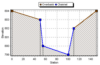
Figure: Definition of Transect data (Source: EPA SWMM Help Manual)
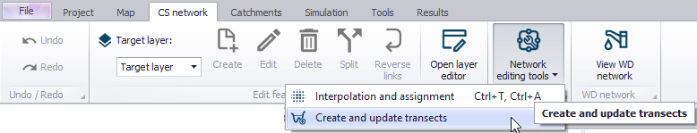
Figure: Access the Create and Update Transects tool from the CS Network menu ribbon
Each transect has a unique ID. When a conduit has an IRREGULAR shape then a user-defined Transect must be set to define the cross-section shape for the conduit.
The SWMM engine converts these data into tables of area, top width, and hydraulic radius versus channel depth. In addition, as shown in the figure above, each Transect can have a left and right overbank section whose Manning roughness can be different from that of the main channel. This feature can provide more realistic estimates of channel conveyance under high flow conditions.
The Transects editor organizes the related input data into the following groups:
- Identification. General identification and description
- Geometric & Hydraulic Properties. Transect geometry and Manning n information
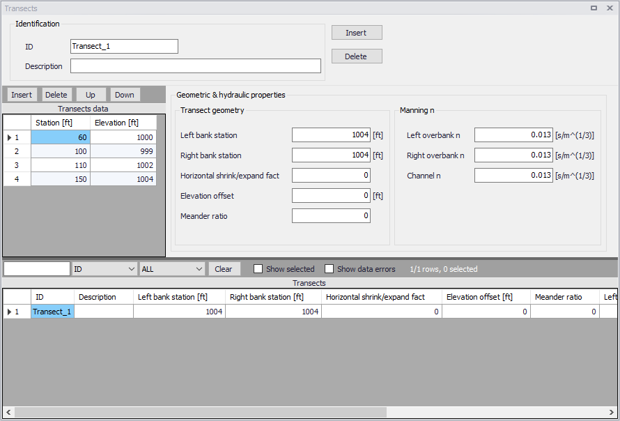
Figure: The SWMM Transects editor
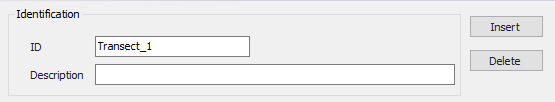
Figure: Transects Identification groupbox
| Edit field | Description | Used or required by simulations | Field name in datastructure |
|---|---|---|---|
| ID | ID of the transect | Yes | MUID |
| Description | Descriptive information on the transect | No | Description |
| Transect Geometry | |||
| Left Bank Station | Left overbank station | Yes | Xleft |
| Right Bank Station | Right overbank station | Yes | Xright |
| Horizontal Shrink/ Expand Factor | Horizontal shrink/expand factor by which the distance between each station is multiplied | Yes | Wfactor |
| Elevation Offset | Elevation offset | Yes | Eoffset |
| Meander Ratio | Meander ratio | Yes | LFactor |
| Manning n | |||
| Left Overbank n | Manning n for left overbank | Yes | Nright |
| Right Overbank n | Manning n for right overbank | Yes | Nleft |
| Channel n | Manning n for main channel | Yes | Nchannel |
Table: Edit fields in the Transects editor (mss_Transect)
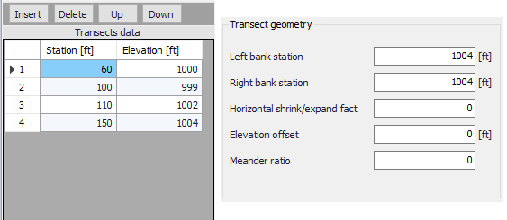
Figure: Transects geometry groupbox on the Transects editor
Specify station-elevation value pairs describing the transect in the Transects Data secondary table.
| Edit field | Description | Used or required by simulations | Field name in datastructure |
|---|---|---|---|
| Station | Distance of cross section station from some fixed reference | Yes | Station |
| Elevation | Elevation of the channel bottom at a cross section station relative to some fixed relative reference | Yes | Elevation |
Table: Edit fields in the Transects Data secondary table