Aquifers
Aquifers are subsurface groundwater areas used to model the vertical movement of water infiltrating from the catchments above. They also permit the infiltration of groundwater into the conveyance system, or exfiltration of surface water from the conveyance system, depending on the hydraulic gradient. The same aquifer object can be shared by several catchments.
Aquifers are represented using two zones - an unsaturated zone and a saturated zone. Their behaviour is characterized using such parameters as soil porosity, hydraulic conductivity, evapotranspiration depth, bottom elevation, and loss rate to deep groundwater. In addition, the initial water table elevation and initial moisture content of the unsaturated zone must be defined.
Define aquifers via the SWMM Aquifers editor in MIKE+. The editor organizes the aquifer data into the following groups:
- Identification
- Aquifer properties
Aquifers are connected to catchments and network nodes through the Groundwater editor (see chapter Groundwater).
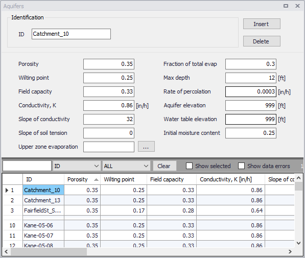
Figure: The Aquifers editor
| Edit field | Description | Used or required by simulations | Field name in datastructure |
|---|---|---|---|
| Porosity | Soil porosity (fraction) | Yes | Por |
| Wilting Point | Soil wilting point (fraction) | Yes | WP |
| Field Capacity | Soil field capacity (fraction) | Yes | FC |
| Conductivity, K | Saturated hydraulic conductivity | Yes | K |
| Slope of Conductivity | Slope of hydraulic conductivity versus moisture content curve | Yes | Kslope |
| Slope of Soil Tension | Slope of soil tension versus moisture content curve | Yes | Yslope |
| Fraction of Total Evap | Fraction of total evaporation available for evapotranspiration | Yes | UEF |
| Max Depth | Maximum depth into lower saturated zone over which evapotranspiration can occur | Yes | LED |
| Rate of Percolation | Rate of percolation from saturated zone to deep groundwater when water table is at ground surface | Yes | GWR |
| Aquifer Elevation | Elevation of the bottom of the aquifer | Yes | BE |
| Water Table Elevation | Water table elevation at the start of simulation | Yes | WTE |
| UMC | Unsaturated zone moisture content at the start of simulation | Yes | UMC |
Table: Edit fields in the Aquifers editor (mss_Aquifer)